The various climbs to the hut from Stubaital
Over the Sulzenauhütte and Lübeckerweg via the Freigergipfel
From the starting point Grawaalm, Sulzenauhütte car park (1670m elevation) via trail no. 136 towards Sulzenauhütte. Between the Sulzenauhütte and the small blue lake, a path runs to the left of the stream towards Lübeckergrat (II). The ridge is secured with wire rope and stepping brackets. The trail proceeds to Freigergrat (3299m elevation). If the fancy takes you, pay a visit to the Freigergipfel (3418m elevation) and descend along the ridge until reaching the Becherhaus (3195m elevation).
Altitude difference: approx. 1800m elevation gain with Freigergipfel
Walking time: approx. 6.30h
Via the Nürnbergerhütte
From the Nürnbergerhütte car park (after Ranalt) 1400m elevation until you arrive at Nürnbergerhütte (2280m elevation). The trail proceeds over the Signalkopf (3392m elevation) down to the Becherhaus (3195m elevation). The trail from the Nürnbergerhütte to the summit is virtually free of ice.
Altitude difference: approx. 1900m elevation gain
Walking time: approx. 7h
Variant 1: From the Nürnbergerhütte, you can also proceed over the Freigerscharte (3012m elevation) via the Roter Grat towards Signalkopf (3392m elevation) down to the Becherhaus (3195m elevation).
Variant 2: From the Nürnbergerhütte, you can also descend via the Rotgratscharte (3012m elevation) to Vogelsee, Teplitzerhütte (2586m elevation) and from there over boulders and well secured passages with wire ropes and stepping brackets, crossing a moraine until you find yourself beneath the Becher rock. The last leg leads you on winding paths until you reach the Becherhaus (3195m elevation).
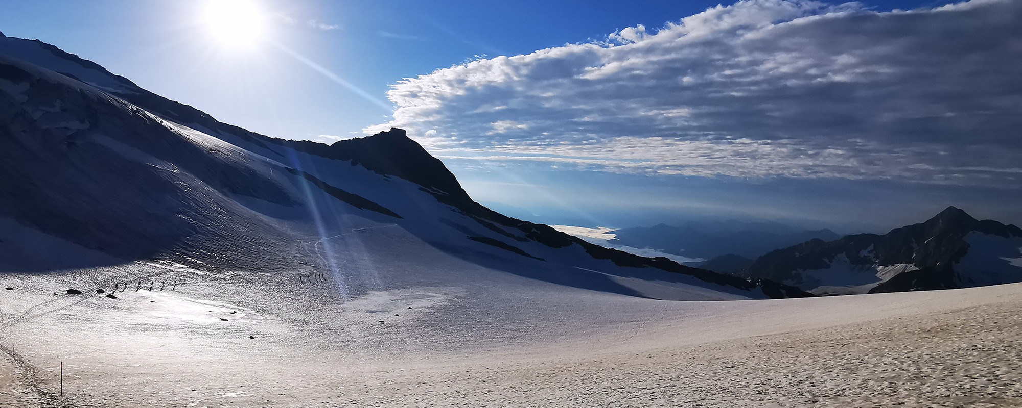
From the glacier cable car of the Stubai Alps
tarting point is the Mutterbergalm car park at the Stubai glacier cable car (1687m elevation). The Stubai glacier cable car will transport you to the Schaufeljoch (3155m elevation), and then continue via the Klierweg over the Fernaujoch, past the Aperer Pfaff to Pfaffenjoch. Your journey then takes you across the glacier. You can now ascend the Zuckerhütl (3505m elevation) or immediately aim for the Wilder Pfaff (3458m elevation) and descend further via the Pfaffengrat (II) to the Müllerhütte (3145m elevation). Below the Müllerhütte, you follow the trail in a south easterly direction across the glacier to the Becherhaus (3195m elevation). The Pfaffengrat is partly secured with wire rope and stepping brackets.
Altitude difference: approx. 600m elevation gain (without Zuckerhütl)
Walking time: approx. 6h
From the Stubai Alps glacier cable car (variant)
Starting point is the Mutterbergalm car park at the Stubai glacier cable car (1687m elevation). The cable car will transport you to Fernau middle station (2300m elevation). There the trail leads you over a bridge, trail no. 102 towards Peiljoch. From here you descend to the Sulzenaufernsee, crossing the new bridge over the glacial stream. At the Fernerstube, keep to the left towards Lübeckerscharte continuing over the Lübeckergrat (II) to the crossing (3299m elevation) beneath the Freiger. Then follow the western Freigergrat to the summit. The ridge is secured with rope and stepping brackets. From there the ridge leads towards Signalgipfel. The descent takes you over Ostgrat (eastern ridge) towards the refuge or below the Freiger traversing the glacier in a south easterly direction, directly to the Becherhaus.
Altitude difference: approx. 1700m elevation gain
Walking time: approx. 5h
.
.